Topic: COMMUNITY INTEREST
Climbing Mount Kilimanjaro on the Marangu Route
By Tammy Duffy
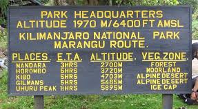
The oldest route on Mount Kilimanjaro, the Marangu route, is also known as the "Tourist Route" or "Coca Cola Route". This route has the least success rate of reaching the summit. Everyone’s goal in climbing Kilimanjaro is to get to the top, to be on the summit when the sun rises over the glaciers and the plains of Tanzania below.
Prior to our trek, we’d heard that the Marangu Route was rather dull on the landscape front. However, we were pleasantly surprised by both the beauty and variety we found each day. As for pace, aside from an especially challenging final ascent, it's all about progression.
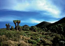
Kilimanjaro is remarkably beautiful. The land over which it rises in such imposing isolation is scarcely less so.
The village of Marangu has an elevation of 5,000ft. From the village the mountain looks overwhelming. However, climbers have little to fear, this is not a technical climb. One must be aware of altitude sickness. Even the most experiences porter can be overtaken by altitude sickness on a trip of the mountain. It's unpredictable.
As we signed in at the base, I had the same thought come over me when I went to run my first marathon. "What the hell am I doing? Can I really do this?" I have ran numerous marathons since my first so I removed the thought of failure from my mind. The team I climbed with were friends I trust with my life. Our guide and porters, the ultimate professionals.
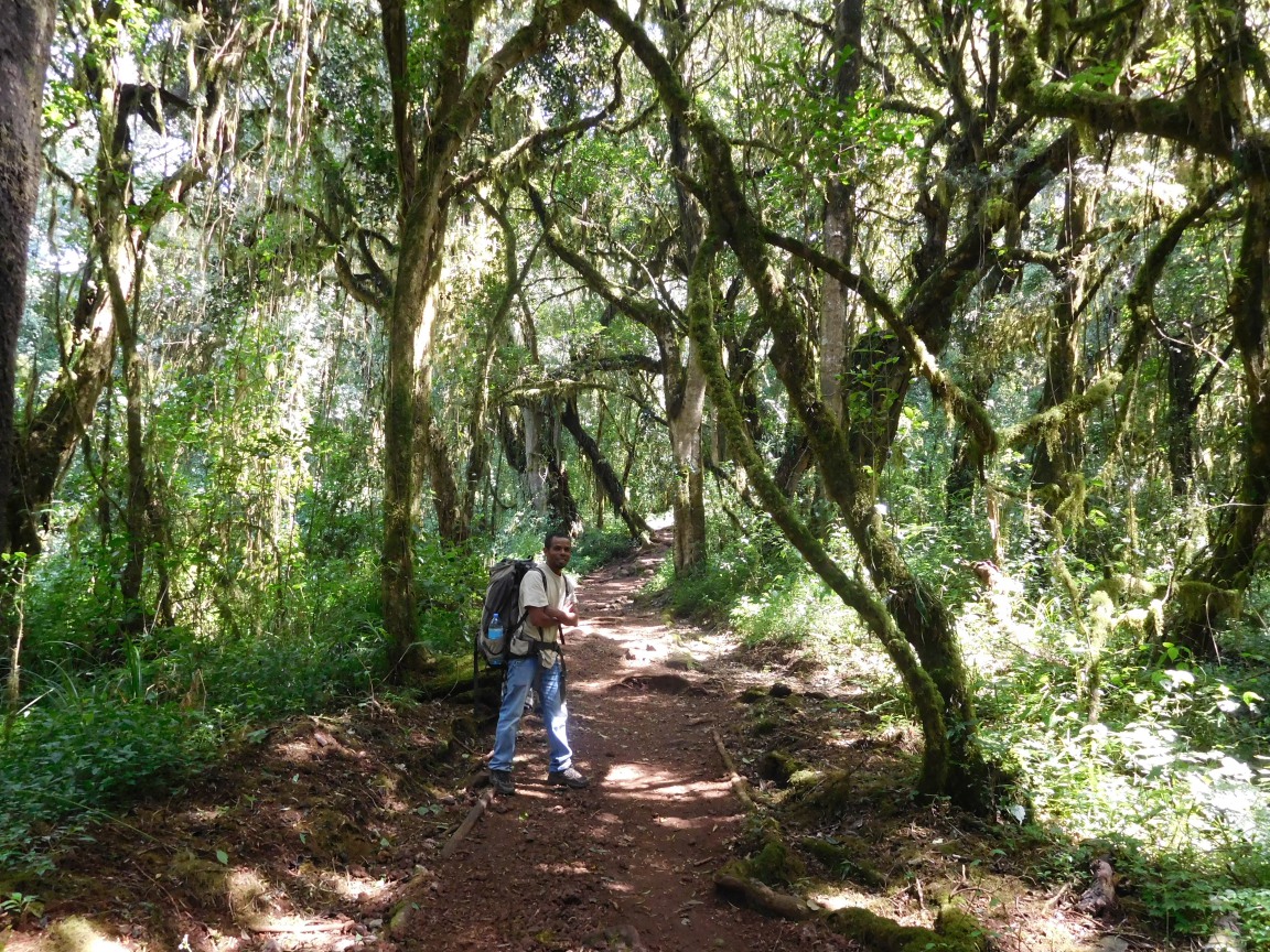
Starting from the base (6,100ft) at the Marangu gate we traversed through a rainforest. You will be surrounded by towering soaring Eucalyptus trees, beautiful flowers, birds, and even the Colubus monkeys. The wide and well formed gravel path is fairly steep and leads steadily uphill, but the forest is so pretty that you don't mind. There are areas of difficult climbing. I soon found that looked to where I had to go (looking uphill) was playing with my mind. I quickly placed a person in front of me so block my view.
For a while the path follows a little stream and it passes a couple of picturesque little waterfalls. The normal time to reach Mandara is 3 to 4 hours. We made it in 2.5hrs. We also saw several colobus monkeys on our trip. They literally ran across our path.
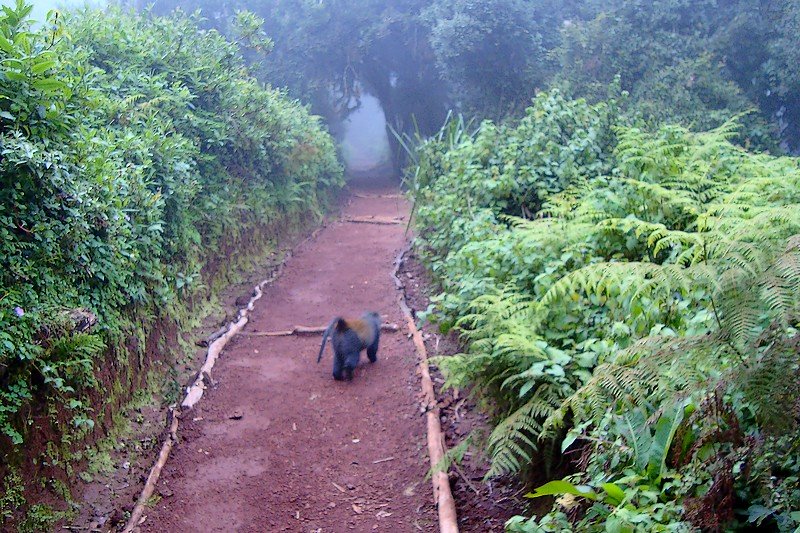
As we near the huts we notice the vegetation change. One enters the next climate and vegetation zone—the alpine heath and moorland. The first heathers appear, but most noticeable is the lichen dangling from all the trees and shrubs, leading to the name "bearded forest". This was an 8KM walk (12.8 miles), 8990 feet.
The atmosphere is that of a rainforest, damp and green on your way up. We rested at Mandara Hut for 20 minutes to each lunch, then continued to Horombo. This is another 3200 foot (5 miles) staircase. One we reach Horombo Hut we are at 12,200 feet elevation. This Horombo zone turns into the moorland zone. The plants in this area are tougher than they look and it is easy to forget that this gentle, rolling country is higher than many peaks. Pole/Pole is the order of the day for the next 3.5 hour trek (another 7.2 miles). We then rest for the evening in the tea houses on the mountain.

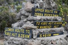
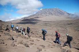
The next day brings us to Kibo. Just after the Horombo huts we pass a stream known ominously as Last Water then some low, striated cliff known as zebra rocks. Ahead is the Saddle, the sway-backed ridge which connects Killimonjaros two main peaks, Kibo and Mawenzi. The upcurve to Kibo takes us to 15.400 ft. We hike 5.7 miles and it takes 5.25 hours.
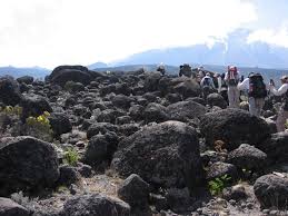
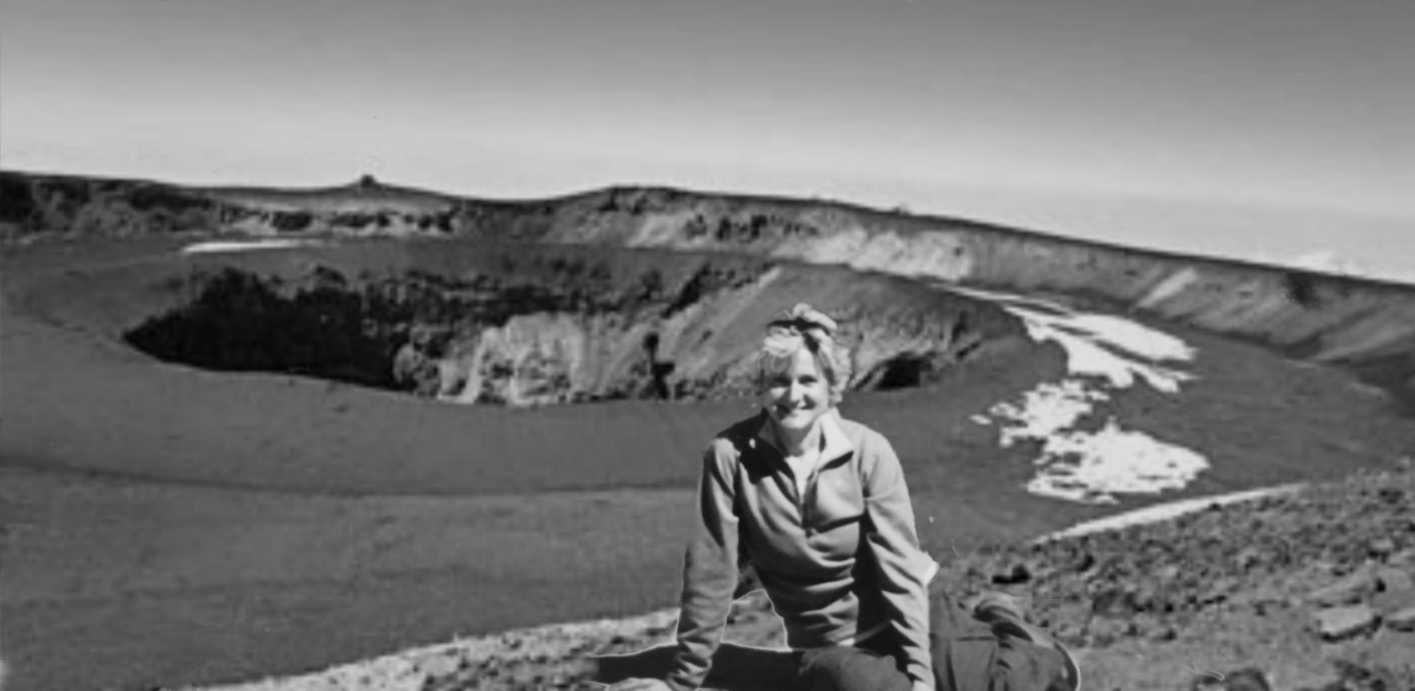
This is the barren plain of alpine desert between the two main peaks of Kilimanjaro: Mawenzi and Kibo. The only living things left are some hardy grasses and the occasional everlasting flower. (How DO they do it? Blooming in this environment.)
We began to feel a bit of the altitude here. The path doesn't LOOK steep, and it isn't (except maybe for the very last section), but the lack of oxygen turns the hike into a major effort. We were all taking dexamethasone to assist in our climbing efforts.
Known among mountaineers as “dex,” dexamethasone is a steroid used to treat high-altitude cerebral edema. Every year about 2 percent of mountain climbers suffer from this life-threatening condition, However, a trend has emerged in which mountaineers use dex to sustain performance and alleviate the symptoms -- nausea, fatigue, dizziness, confusion, mood swings -- of acute mountain sickness. The use of dex to increase exercise capacity for high altitude climbs is controversial and poses health risks.
Dexamethasone can increase your exercise capacity via various mechanisms. For example, it boosts the amount of nitric oxide in your system, reducing the pressure in your pulmonary arteries. It enhances your body’s ability to remove sodium and water, which facilitates the diffusion of oxygen. Because it eases inflammation, dex helps you to achieve a positive frame of mind. While a single dose can be life-saving in the case of high-altitude cerebral edema, some climbers are regularly taking dex prophylactically before the effects of high altitude have yet to kick in. They claim that the steroid use equates to the use of supplemental oxygen, both of which make a high-altitude climb easier
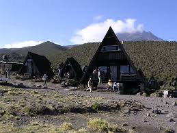
You will be looking at Kibo the whole time, and you will be having a good view of the challenge that lies ahead for you tonight.
(huts are on the left, summit trail in the middle). The huts are a dreary place. We all huddle into sleeping bags to rest. We have to wake up at 1:00AM to begin our ascent to the summit. We zigzag to Gilman's point at dawn and see the amazing sunrise. The reason for the early start is to see the sunrise and to maintain a visual ignorance for what is ahead. If you clearly saw what you had to climb, you may turn back.
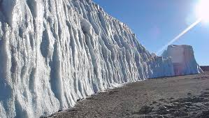
As we plod on, we create a slow yet staccato rhythm. Our guide was singing to take our minds off the the climb. The guides do an amazing job of creating distractions for the hikers. At this altitude, oxygen is cut by 50%. Our breathing becomes laborious and we stop frequently for quick one minute breaks. Our trek was filled with switchbacks, winding you up the steep scree before reaching Gilman’s Point on the rim of the crater (18,640 ft/5,861 m). Here, you are greeted by the snow-filled crater and its icecaps. Hiking along the crater rim, you will reach Uhuru Peak. The true summit is Uhuru point, only 700 feet from Gillman's point. This takes another hour to reach the true summit. We were then standing on the Roof of Africa! It was important to begin your descent immediately soon in order to allow yourself enough time to rest at the Kibo Huts. Upon reaching back to Kibo, we have lunch, grab some much needed rest. We descending the next day refreshed in 10 hours.
At each Gate you have to sign in. By the time you get to the last gate, you are a bit disoreiated and have great difficulty writing in the information.
Day 1 - Marangu Gate (1860 m/6100 ft) - Mandara Huts (2700m/8860 ft)
Walking distance: 8 km/5 miles
Walking time: 3-4 hours : We did 3.5 hr
Altitude gain: 840 m/2760 ft
Day 1 - Mandara Huts - Horombo Huts (3700 m/12140 ft)
Walking distance: 12 km/7.2 miles
Walking time: 5-7 hours: We did 5.7 hrs
Altitude gain: 1000 m/3280 ft
Day 2 - Horombo Huts - Kibo Huts (4700 m/15420 ft)
Walking distance: 9.5 km/5.7 miles
Walking time: 5-7 hours: We did 5.25 hrs
Altitude gain: 1000 m/3280 ft
Day 3 - Summit via Gilman's Point (5700 m/18700 ft) to Uhuru Peak (5895 m/19340 ft) and descent to Horombo Huts (3700 m/12200 ft)
Elevation(ft): 15,400 ft to 19,340 ft to 12,100 ft
Distance: 4 km up/2.5 miles
Hiking Time: 10-15 hours : We did it in 12 hours
Habitat: Alpine Desert.
We completed the entire walk down, walking distance: 21 miles, in 10 hours.
